Biomass imagery
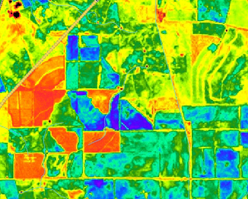
Yearly biomass maps produced from satellite imagery at farm or paddock scale. These maps show productivity and variability of farming land in the south-western agricultural area of Western Australia.
More Info »Land Surface Temperature
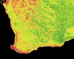
Land surface temperature imagery can provide information on the spatial extent of frost areas within Australia.
View »Services
Many custom services are available in a range of applications utilising satellite imagery at a choice of resolutions.
How can we help you?
- Disease detection
- Disease monitoring
- Land management
- Crop yields
- Estimating pasture growth and biomass
- Predicting total available dry matter feed
- Tree count (vineyards)
- Drought monitoring
- Soil erosion/assessment
- Irrigation monitoring
- Monitoring of market gardens
- Insect infestation
- Your idea...
Agriculture Contact
Norm Santich
Phone: +61 8 92737373
norman.santich@landgate.wa.gov.au
