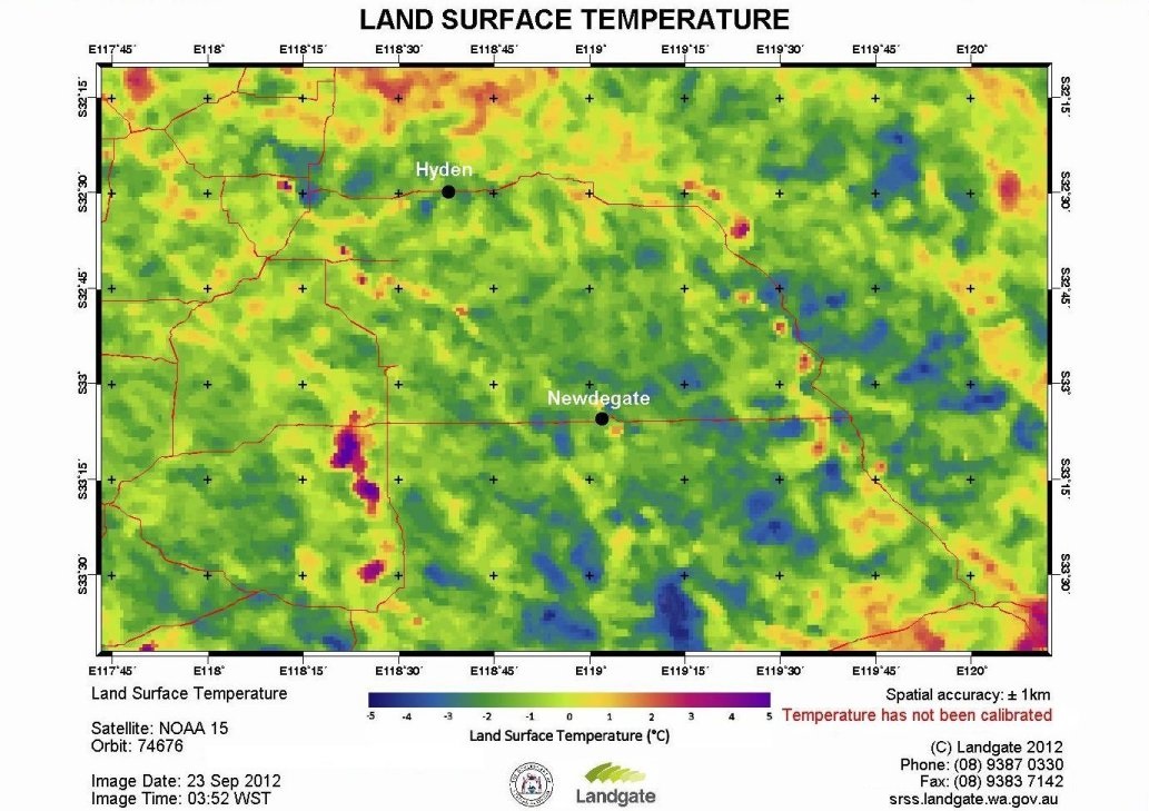
During September 2012 some parts of the Western Australian wheatbelt region suffered frost damage. Farmers from a crop improvement group in the south-eastern wheatbelt of Western Australia were interested to see the spatial extent of the land surface temperature to get an idea of what parts of the region may have suffered frost damage. They approached SRSS to create a land surface temperature customised product over their area of ineterest. The image below was produced from the NOAA-15 satellite on 23rd September 2012 at a time of 3:52am Australian Western Standard Time (WST). Although the temperatures in this image were not calibrated with actual ground measurements it does show the difference in relative temperatures. The Department of Agriculture and Food's (DAFWA) weather station at Newdegate recorded a minimum of -2.3 degrees at about 5:50am WST.
Contact
Mike Steber
Phone: +61 8 9387 0349
mike.steber@landgate.wa.gov.au
